
WASHINGTON STATE, BABY.
Well, Western Washington… A very different place than Eastern Washington.
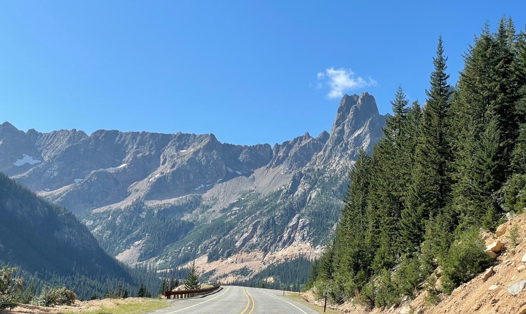
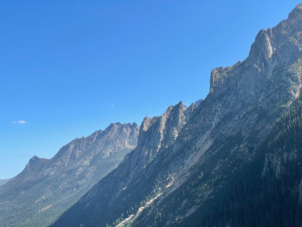
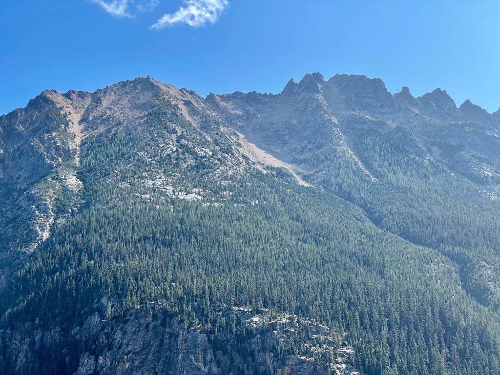
We left Mazama in Eastern Washington with hopes of finding a campsite in North Cascades National Park.
With views like this coming into the Park, we were crossing our fingers and our toes.
Unfortunately, the options were limited and all taken. 😦
The mountains were beautiful but “When We Come Back” I NEED to get down to the water… In this first video, you’ll hear one of my initial reactions… 🙂
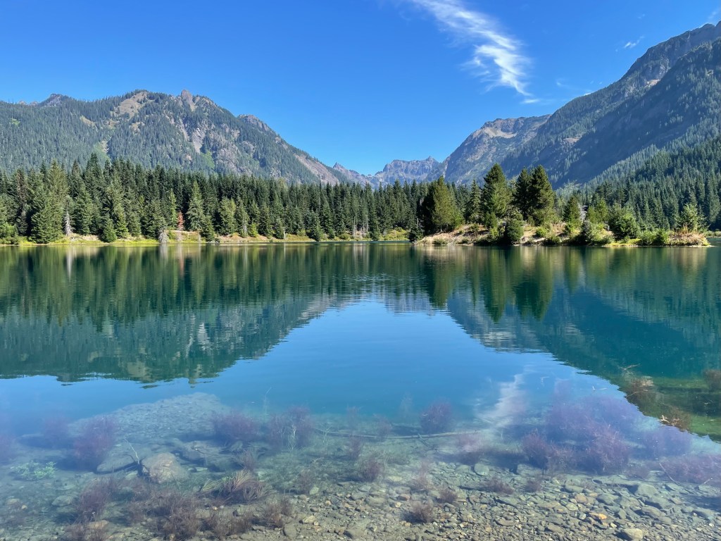
By time we made it the other side of the National Park, an hour and a half from our starting location, we still weren’t sure where we were going to land for the night. We had a couple other options on our radar to try, but nothing seemed to be what we were hoping for; it was either too far from things we wanted to do orrrrrrrr a Walmart (also not the kind of stay we were looking for). We drove and drove and drove…Finally, 6 hours after leaving that morning, we made it into Snoqualmie Pass and found the most perfect site at Keechelus Lake. I’ll admit, I was hesitant to give it a try but to my surprise, it was an absolute GEM of a find.
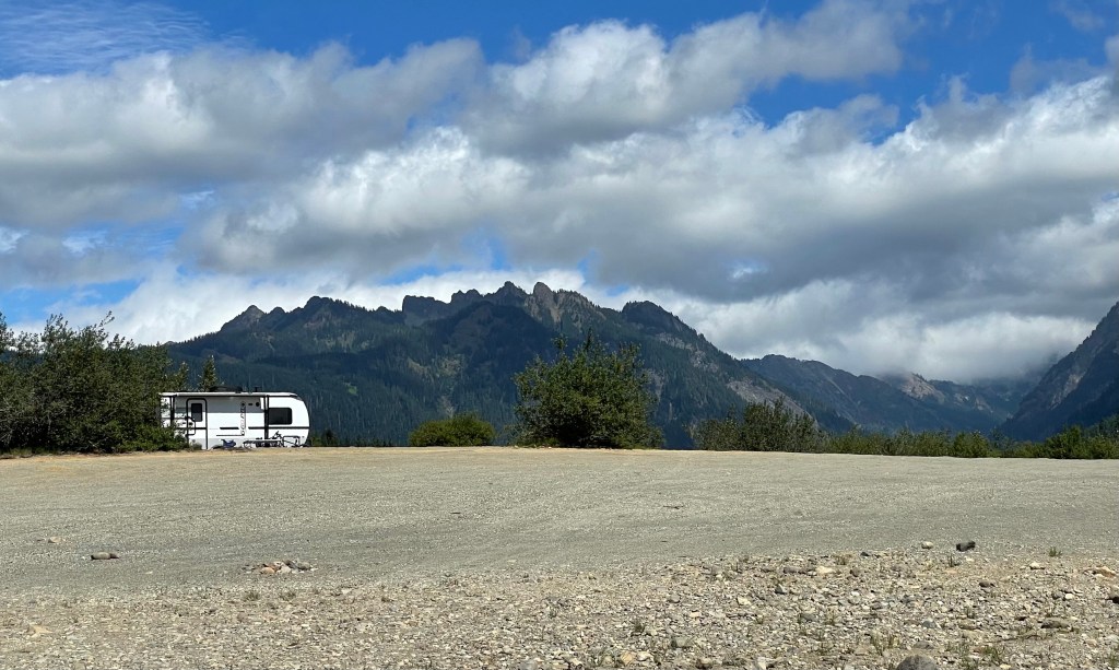
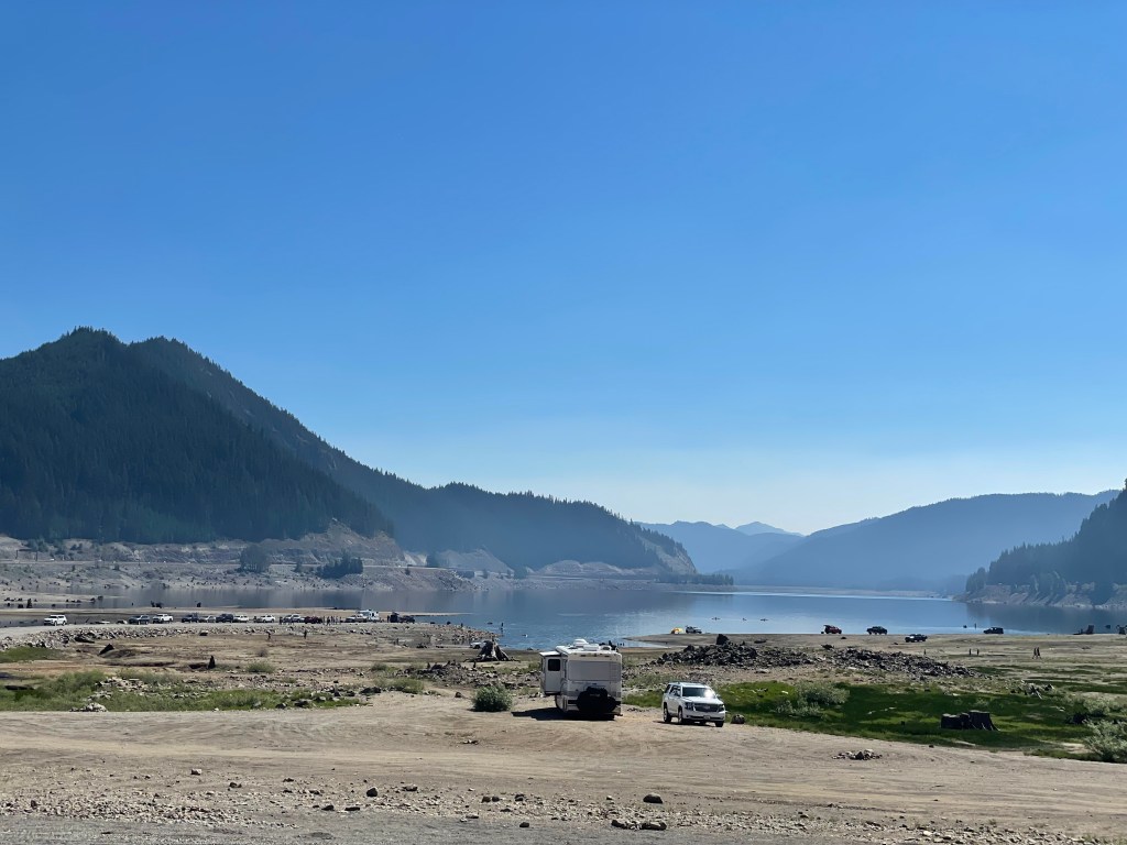
This site gave us great access to the nearby hiking trails and was just over an hour into Seattle. From Pike’s Place to Keechelus Lake, Google Maps has the travel time as 1 hr 12 minutes. Even with the hum of the nearby interstate, it was fairly quiet from one site to the next.
One afternoon, we even got to see some paragliders come in!!
Our hiking adventures start at Snow Lake. After Snow Lake, we’ll take you on a trip to Gold Creek Pond and then we’ll finish with Franklin Falls and Rattlesnake Ledge. These hikes were not all done in the same day, but were all completed within our stay at Keechelus Lake, giving us just about 15 miles altogether. Again, using Pike’s Place as our exact Seattle location, all of these trails are only 45 minutes to 1 hr 5 minutes away!
If you like hiking, check these out!
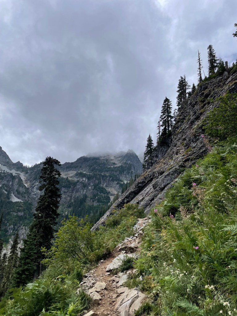
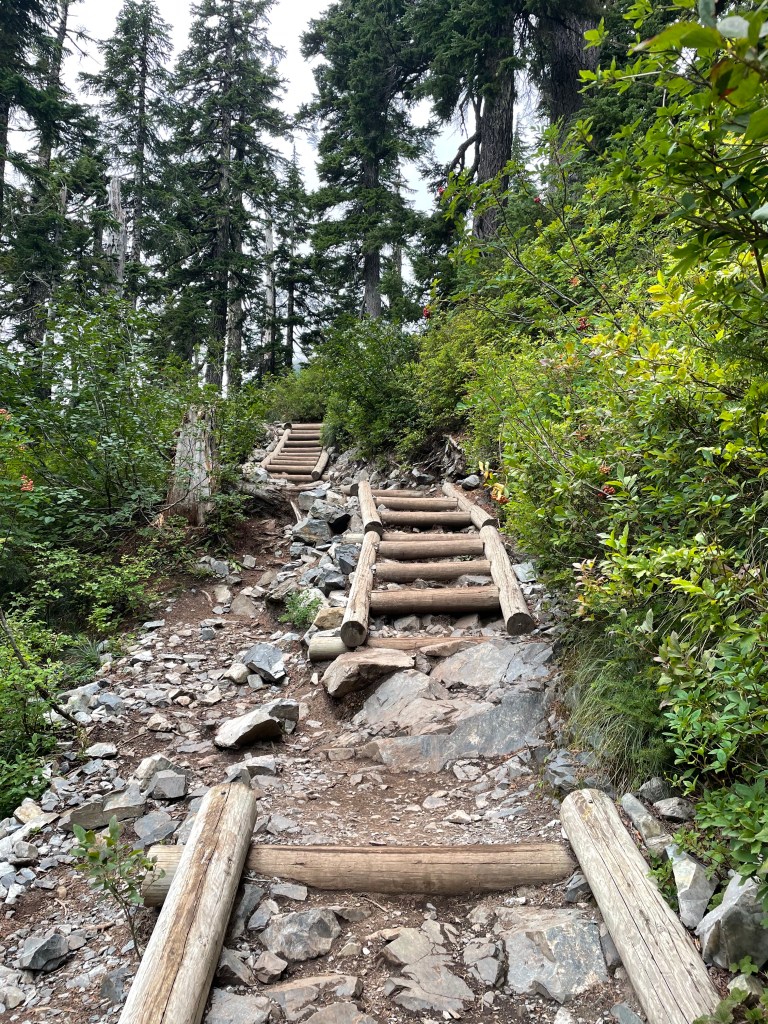
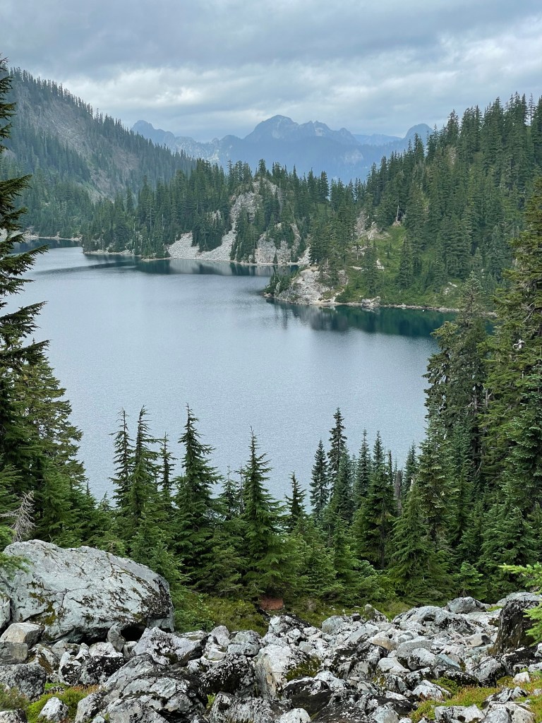
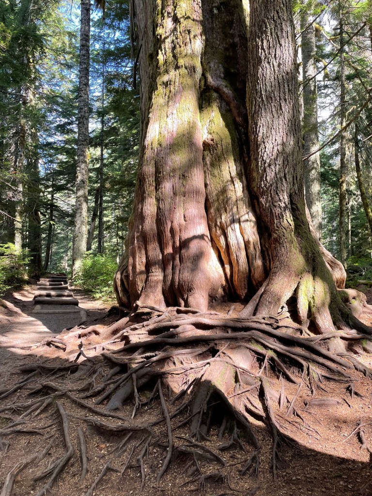
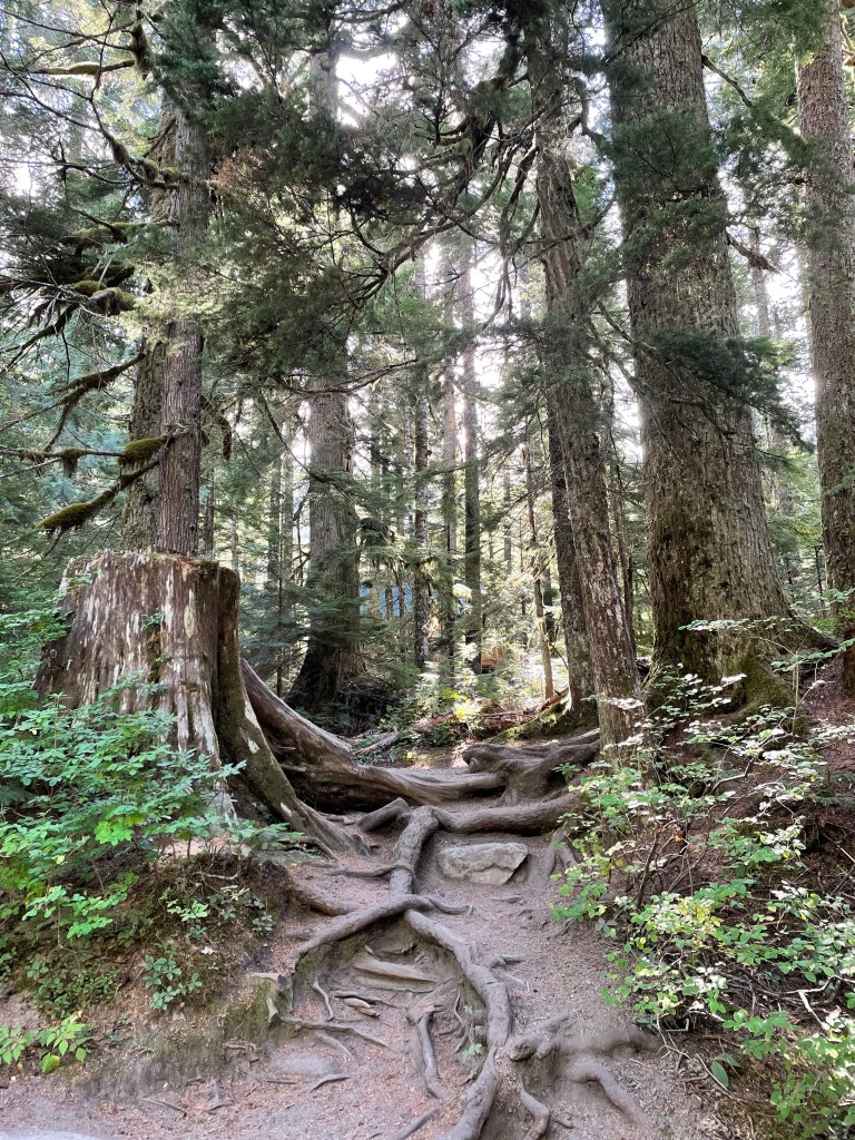
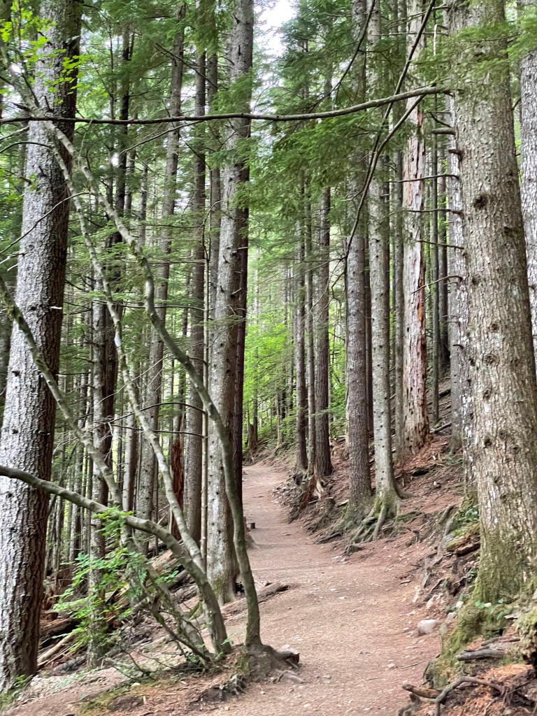
SNOW LAKE (5.97 miles)
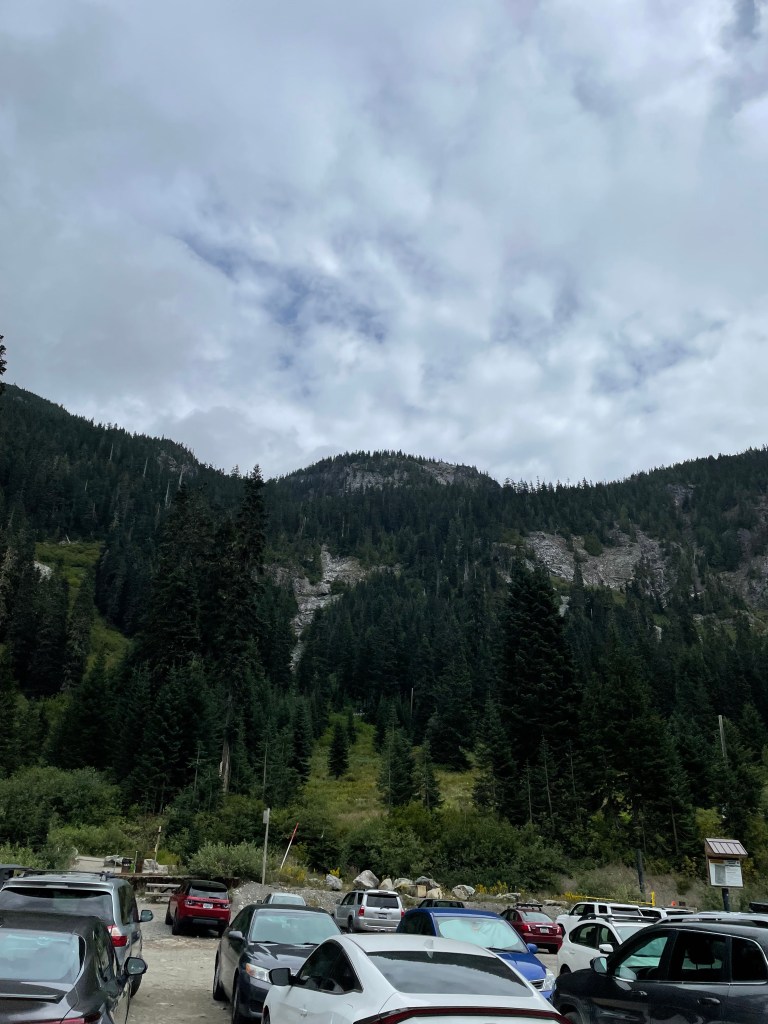
Welcome to the Parking Lot. Despite all the cars you see, most belonged to the nearby Ski Resort. This mountain you see in front of you, however, is our main objective for the afternoon.
Up.
And over.
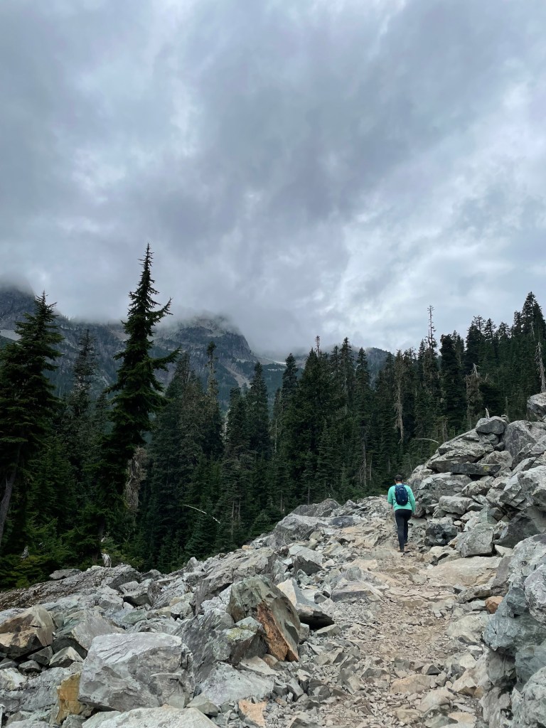
The trail wasn’t terribly difficult, but I also am not in the best of shape, so you’ll have to excuse my heavy breathing in the next few videos…
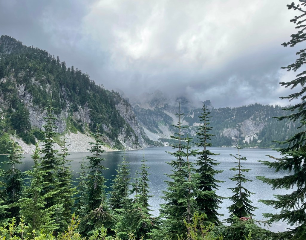
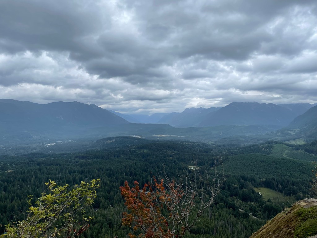
Nonetheless, I felt good hiking. Despite the clouds, the temperature was PERFECT.
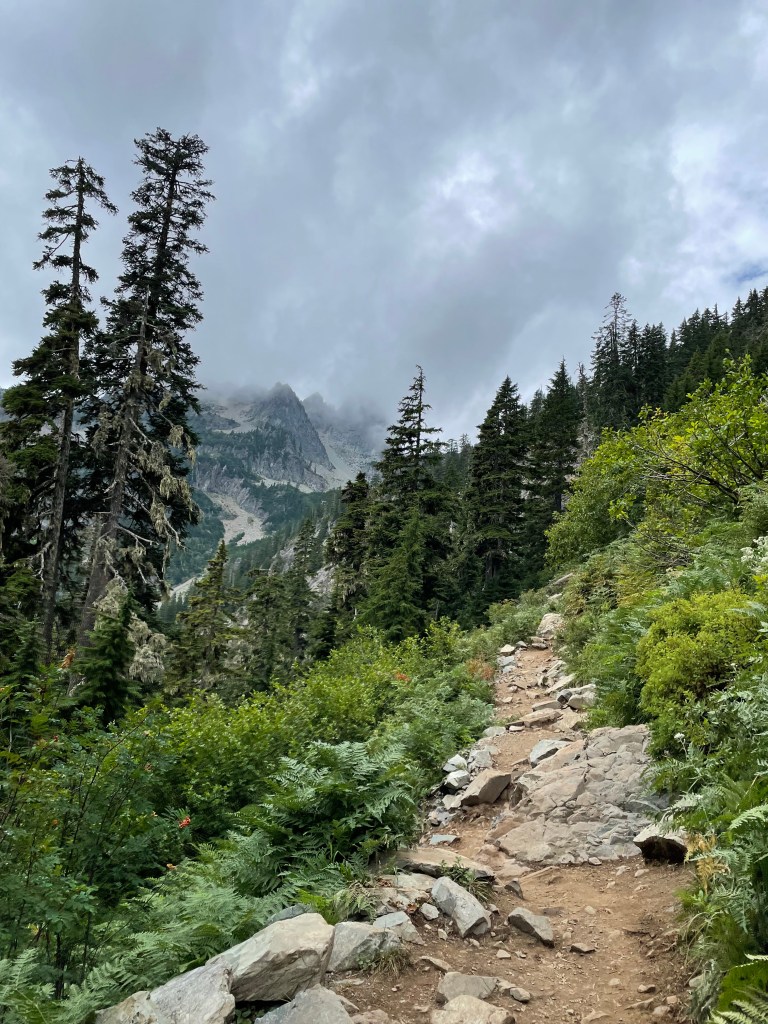
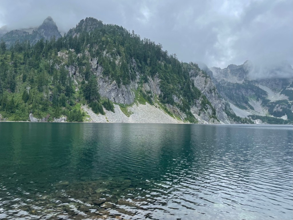
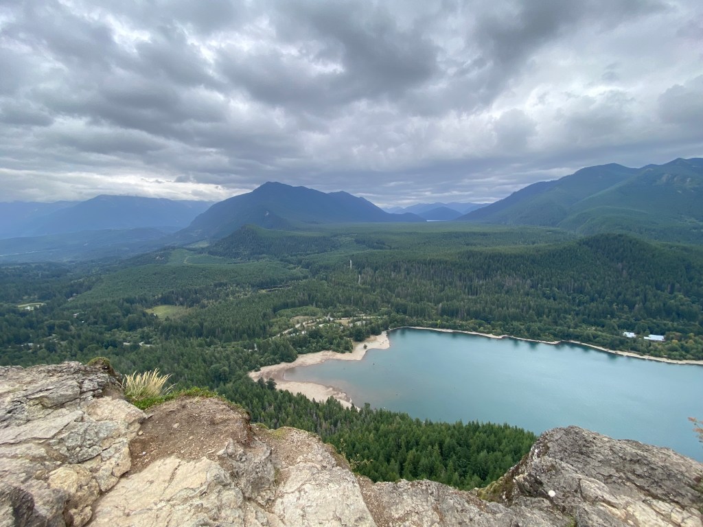
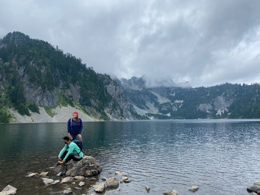
About an hour and a half later, we made it to the top!
And thennnnn you start the zig-zag trail down to the lake… If you look closely, you can see someone with a red backpack further along the trail getting closer to the bottom.
As always, going down hill was just a little bit easier; this portion only took about half an hour.
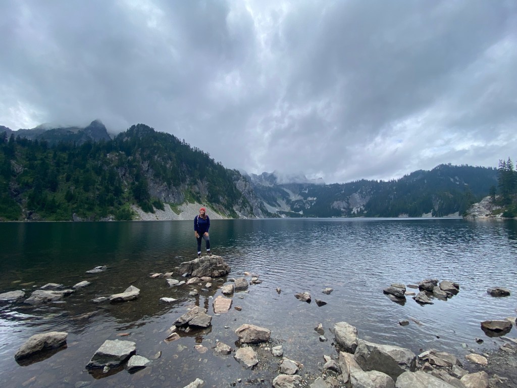
BUT YAAAAAY! WE MADE IT!!!
We enjoyed our typical snack of string cheese and capri-suns before starting the trek back up and over the mountain…

If the weather had been just a little nicer (and we were in slightly better shape), we would have continued the hike on to Gem Lake. But alas… we’ll save it for “When We Come Back”.
Up we go…
Down we go…
The parking lot is in sight!!!
Overall difficulty rating: 6/10; moderately difficult for the energy it requires, but incredible views the entire way.
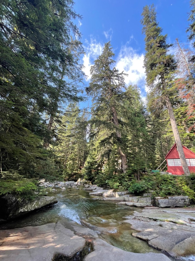
GOLD CREEK POND (1.42 miles)
We were pleasantly surprised when we arrived at this semi-paved and mostly level trail! It was a “walk in the park” in terms of ease, beauty, and accessibility.
It wasn’t long before the trail opened up to the water. If I remember correctly, I don’t believe you’re allowed to swim in the pond…
Anyone else obsessed with suuuper clear water like I am? and this COLOR? Insert crying emoji here because I am weak in the knees for views with these elements.
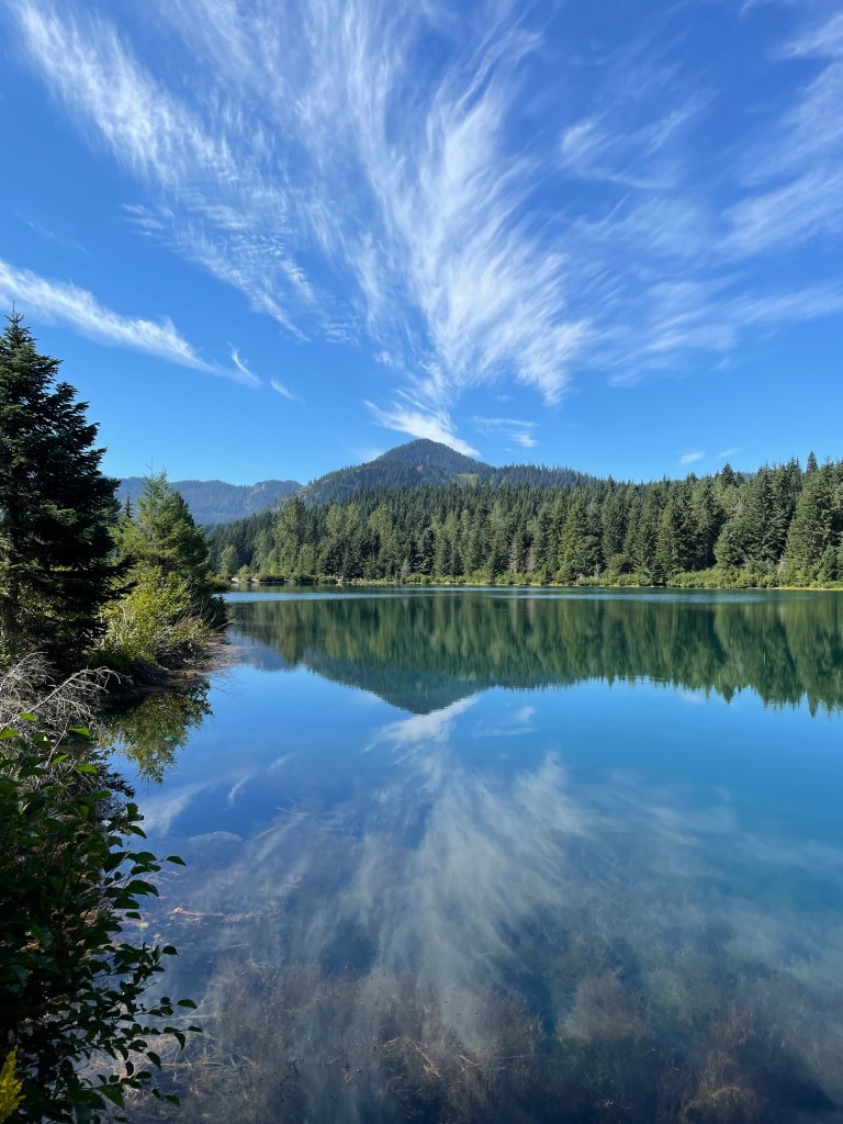
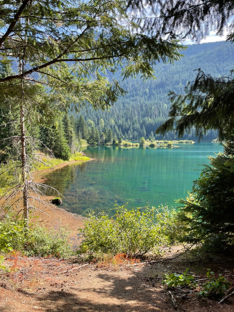
Overall difficulty rating: 2/10; super easy to find and to accomplish, check this one out if you’re nearby!
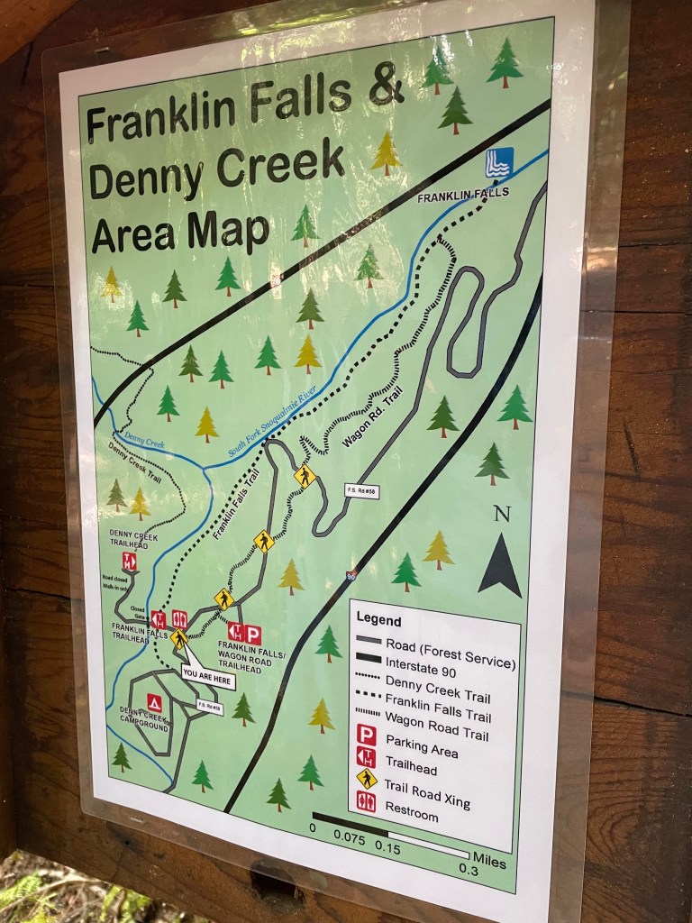
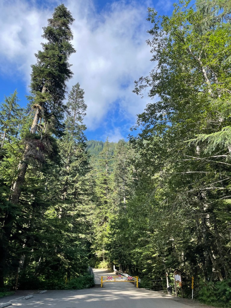
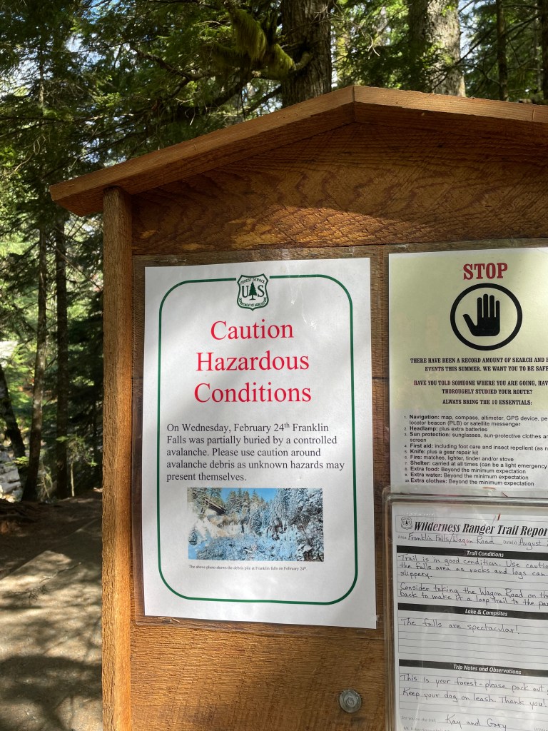
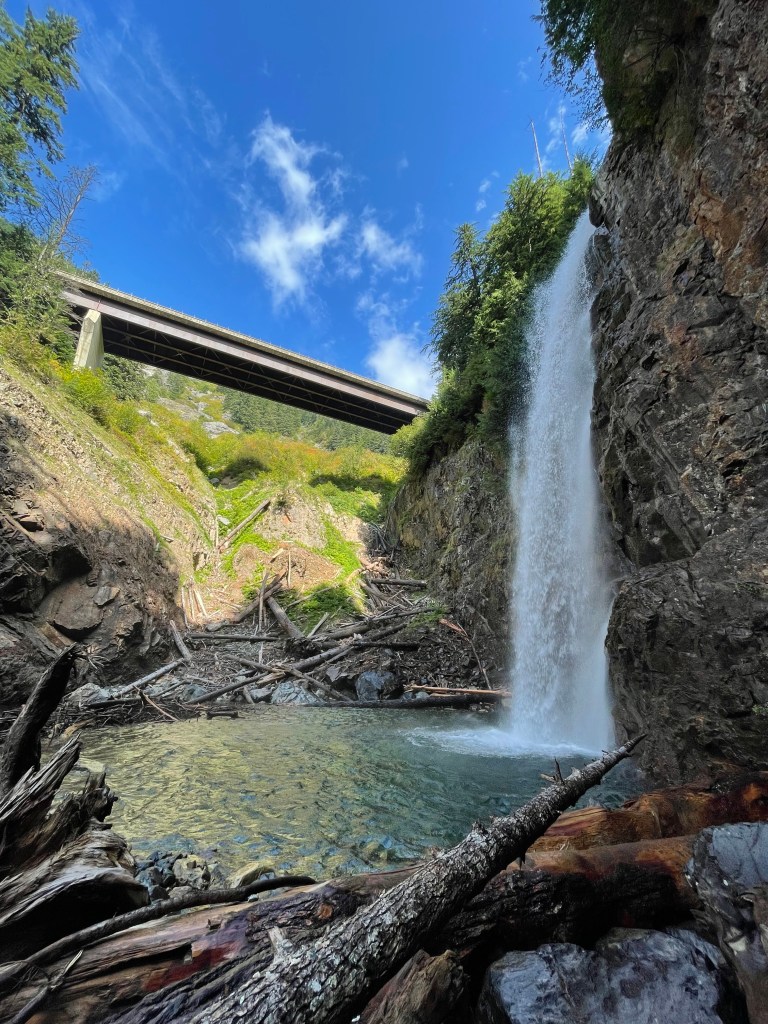
FRANKLIN FALLS (2.55 miles)
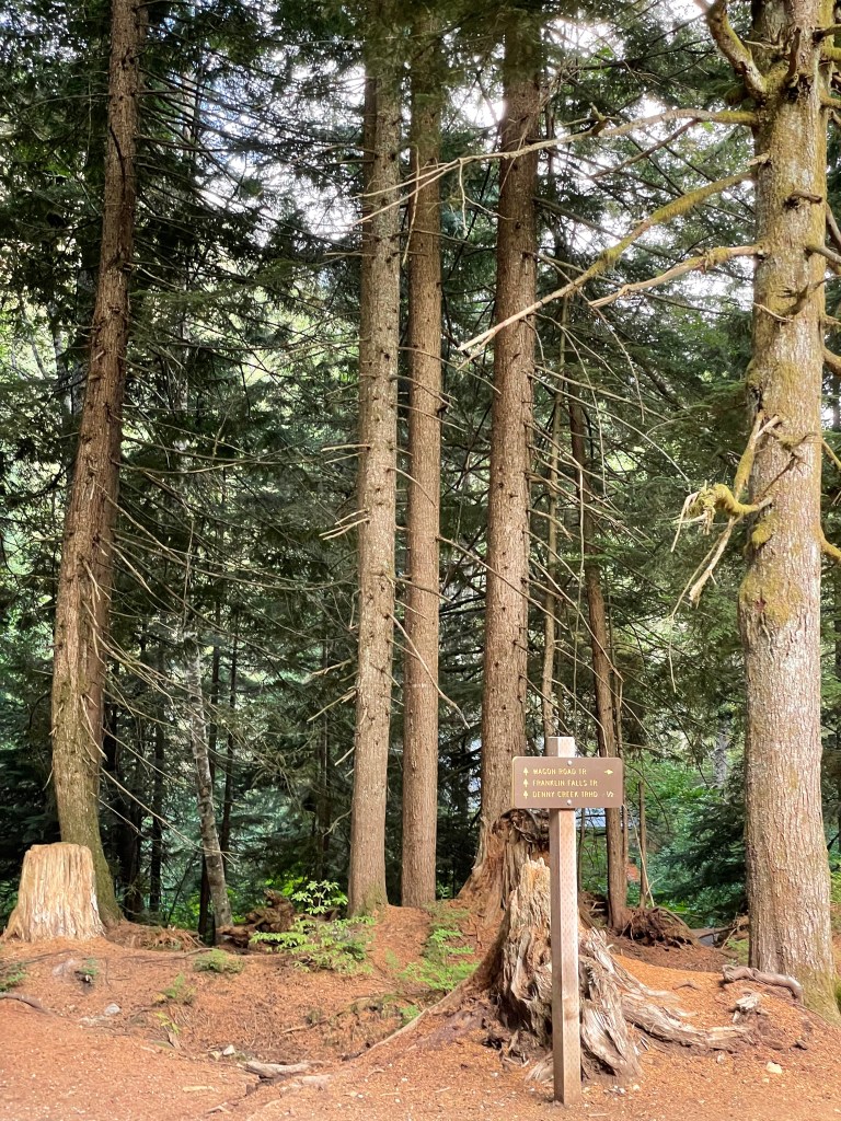
This one was a little more difficult to find the trailhead. From where you park and the actual trailhead, it can be a little confusing to find.
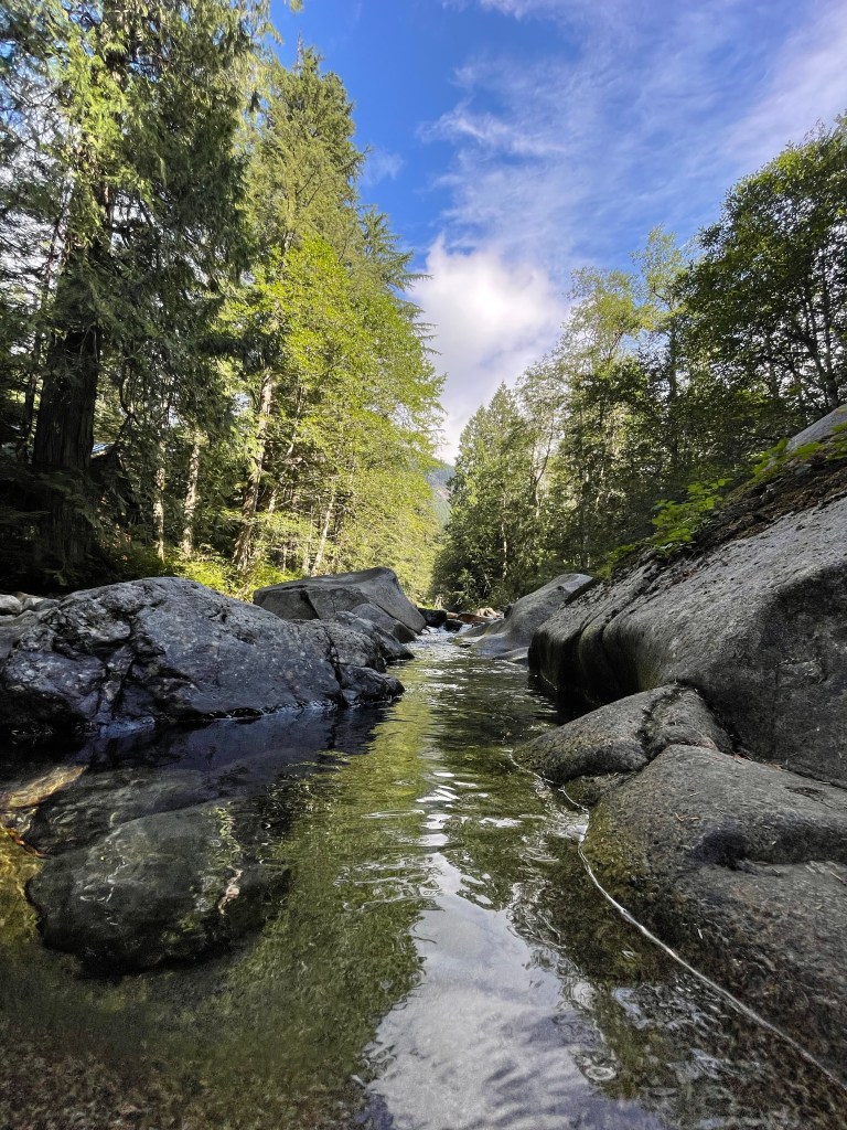
For some reason, it’s always the 3 – 4 mile trails that I quickly get defeated. I’m not sure if it’s the eager and anxious feeling of “1.5 – 2 miles isn’t that far, how are we not there yet!” or WHAT, but these are always the trails I feel more tired… Nonetheless, we took our time to play with our cameras and walk out on the river a little bit. This trail was a little bit more “technical”, with just a little bit of incline, so be careful, and watch where you’re walking as to not trip over some of the tree roots!
When you finally make it to the Falls, the descent can feel a little steep as you take step after step down to the bottom. Again, the trail here is very rocky and can be easy to misstep! It is super funny, though, to climb all over the big logs and go to the base of the fall and feel the mist on your face…
Enjoy these pictures and videos of yet another place I wish I could have jumped right in.
It’s hard to put into words how FREAKING AMAAAAAZING the mist from this water felt.
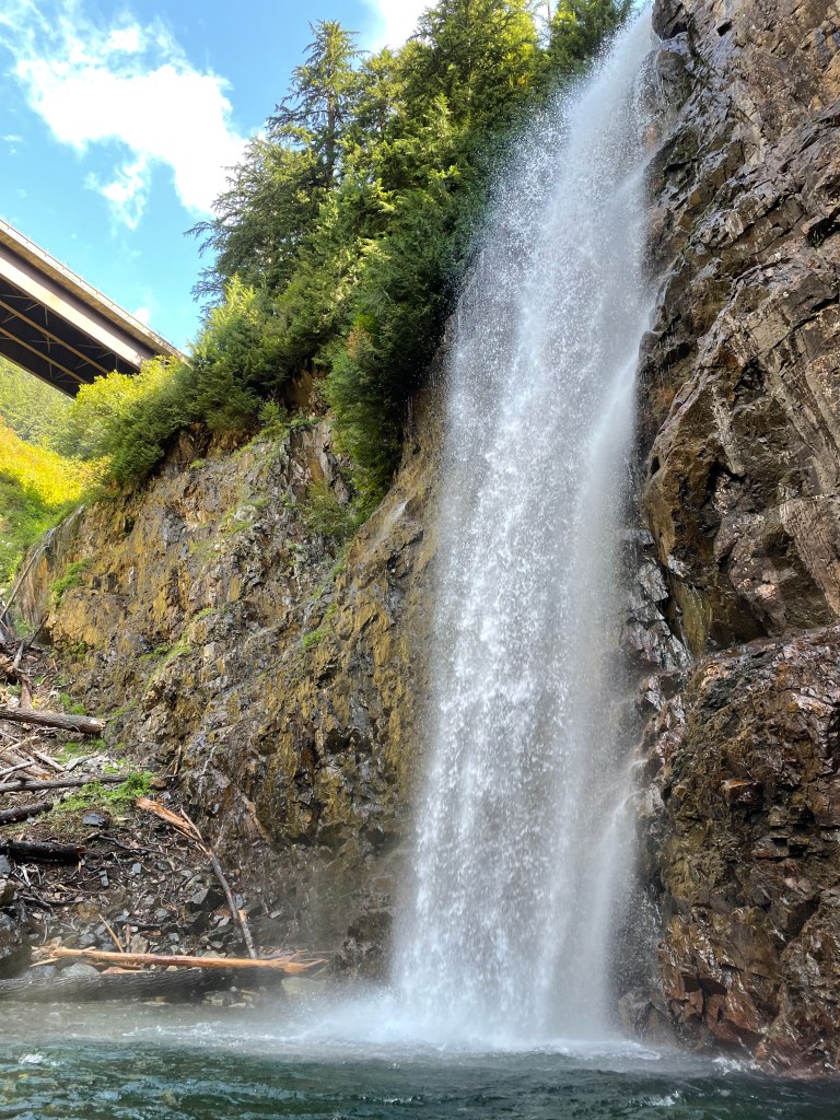
Again, the water clarity had me…
One final stare before we head back…
Overall difficulty rating: 4/10. Requires some mental effort on the trail and down at the falls to watch where you’re walking, but AWESOME place to be once you’ve made it.
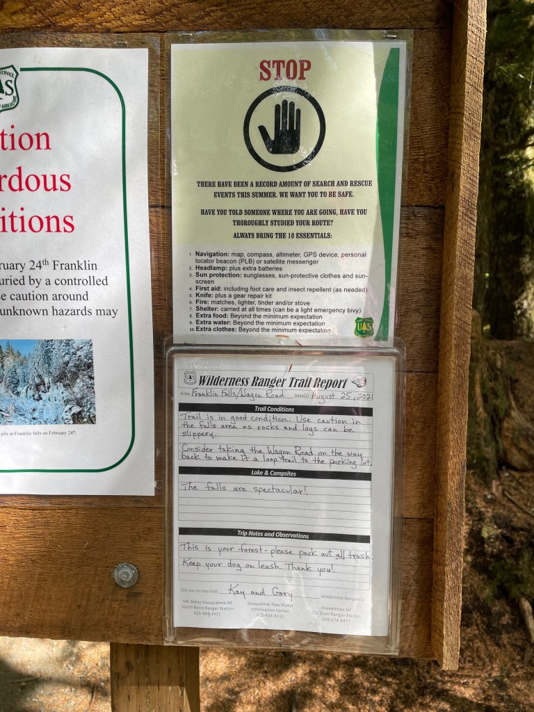
Unfortunately, we didn’t pay attention to the trail report saying to take Wagon Wheel Trail on the back to make a loop, but “When We Come Back”, I’d definitely like to give it a try!
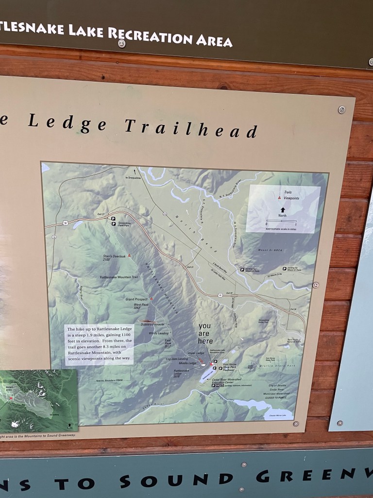
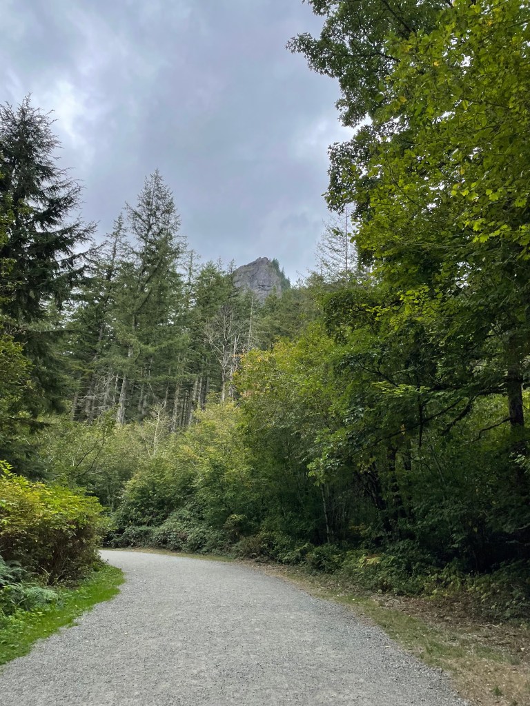
RATTLESNAKE LEDGE (4.80 miles)
I’ll go ahead and let you know this one was tough for me. Any and all hiking guides for the area will recommend this trail, and while I do too, I’d do the first three I mentioned before I gave this one a try. Honestly, this was one of the last trails of we did and I think I was just out of steam, burnt-out. But I promised Devon I would do one more and that he could pick it… I should’ve known he’d pick a 5-miler…
It alllllllso didn’t help that we were doing it on a cloudy day…
and there were people everywhere at the top…
and the trail up is brutally inclined…
IF I’M BEING HONEST, it was just a liiiiiittle overrated for me!
Nonetheless, here’s the evidence I did it:

This tipppppy top point above the trees is where we’re going…
Whatever you’re imagining as the incline, I promise this felt worse.
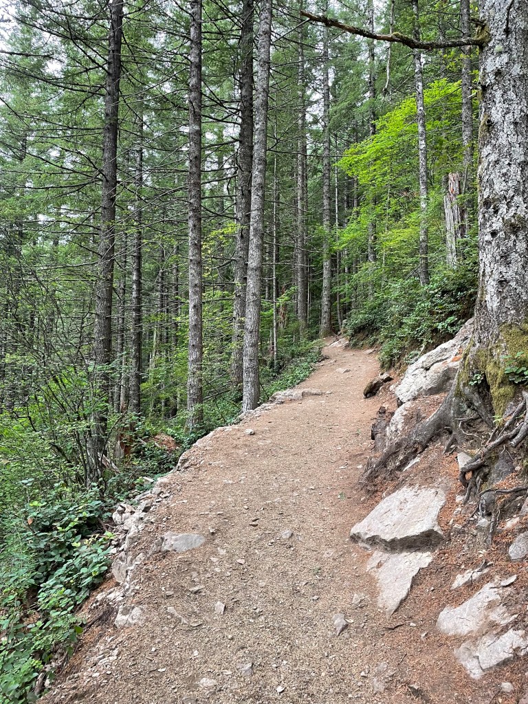
As far as overall quality of the trail of the itself, it really was fairly well maintained (and apparently receiving even more attention in maintenance as we speak!).
BUT MAAAAN, the whole dang thing was uphill and my legs were feeling EVERY step!!
This video is from our descent, but notice the incline of this switchback we tackled on the way up!!
And then finally, we made it to the top!
Did someone lose their squeaky toy up here???? Just kidding, that’s a squirrel!
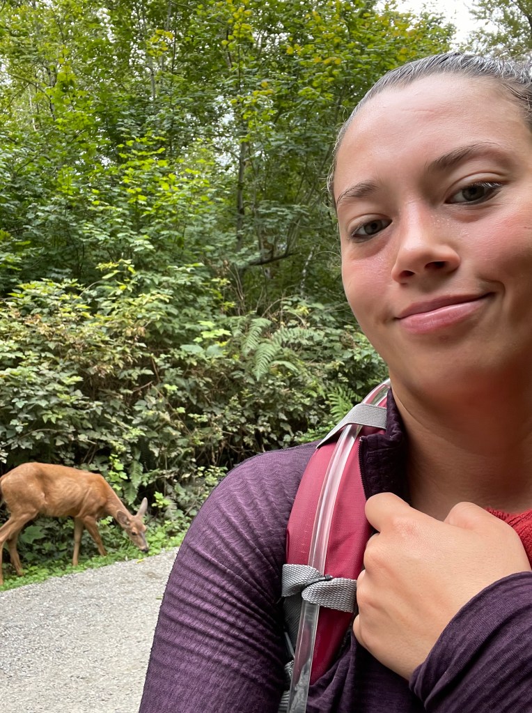
When we finally reached the bottom, we made a new friend!!
Overall difficulty rating: 6/10, this trail definitely required some EFFORT to get up to the top, but it’s attainable if you take your time.
.
.
.
We did it! We hiked almost 15 miles! My legs are tired just thinking about doing it all again.
And yet,
I would still do it all again.
Consider this training for one of our next big hikes to come.
Next stop: SEATTLE!
Until then,
j&d
((( A big thank you to my dad and his photoshop skills for making us a picture together :’-) )))
